|
Stonethewaite, Greenup Edge,
High Raise, High White Stones, Stake Pass, Langstrath. Cumbria. |
|
|
Start/finish OS grid
ref: NY 2603 1391 |
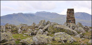 View from High Raise to Scafell Pikes |
|
|
It was overcast but bright and good walking conditions. Further up Greenup Gill I kept a lookout for a suitable flat spot for the planned camp. I had an uneventful climb up the path to Lining Crag and on up to the summit of Greenup Edge. A long way below were a couple of walkers but none up ahead. I turned right and headed up to Low White Stones and then on to High Raise. There was hardly any wind and it was a pleasant viewpoint to stop for a while. I started to descent to the west and below I could see a faint path heading towards Stake Pass. |
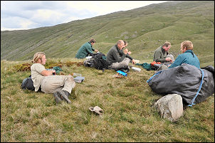 The path makers having lunch on Stake Pass. |
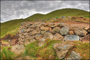 Part of the new path on Stake Pass. |
|
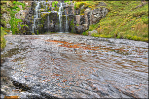
I didn’t head for it though but started to traverse below High White Stones to the north. There was a nice clear spring and further on a good flat spot for a possible future camp. I began to descent directly towards Langstrath and then turned left to follow the contour and look at some interesting waterfalls. On Stake Pass I could see a group of work men digging out for foot path improvements. I walked over to thank them for their efforts then had a look at the work they’d been doing before descending the path into Langstrath. |
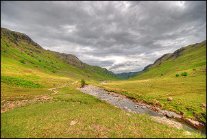 Langstrath looking north. |
|
|
There were now a few people about and after crossing the wooden footbridge at Tray Dub there were even more. I wandered down the wide valley taking a few photos on the way before reaching the gate and stone track. I’d thought of walking up to Cam Crag to check out the hidden bothy but the now ferns were growing and would have been too difficult to wade through. I decided to take the direct descent down the track to the path through the camp site and back to the car. I then drove to Patterdale to leave another food depot then via Shap to have tea at the transport café at Tebay. |