|
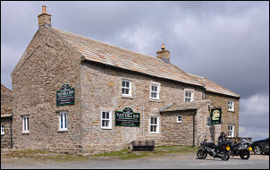
Tan Hill Inn, Keld, Blakethwaite
Smelt Mill, Great Punchard Head, Kirk Fell, Yorkshire. |
|
|
Start/finish OS grid
ref: NY 8969 06666 |
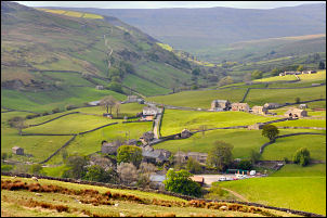 Keld |
|
|
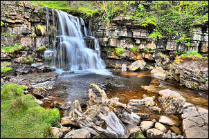
The miles soon passed as I approached Keld. The small village sits at the bottom of the valley and doesn’t appear until quite close. As I descended past East Stonesdale I met the first walkers of the day. Three walker heading north, presumably doing the Pennine Way. In the valley bottom more walkers were out and heading east, presumably doing the Coast to Coast. At East Gill bridge is a delightful waterfall with a grassy area below and a bench at the top for sitting and admiring the views. It was 29 years since I was here last when I walked the Coast to Coast with Charlie. |
|
I followed the track east to Crackpot Hall where I sat in the ruins to enjoy a cup of coffee. I chatted briefly with a couple of senior ladies who were dong the C to C walk. I caught up with them further upthe lane and we struggled to open the gate against the fierce easterly wind. The reason Wainwright, who devised the walk, suggested it is done west to east is because of the prevailing west to east wind. For the past few days its been the opposite way. The path skirts the side of Swinner Gill to cross a nice stone bridge to reach some ruins. The continuing path up East Grain soon deteriorated to almost nothing and was just a muddy mire in places. I came to a stoned track and a misleading path sign. The track was the correct way but the sign pointed out to rough moor. I was now on the high flat moor and the going was easy. |
 above Crackpot Hall |
|
|
At the disused Lowanthwaite Lead mines I came to the top of the North Hush and followed a minor path directly towards the Blakethwaite Smelt Mill where I walked last week. At the ruins I climbed to the old kiln and sat in its base out of the wind to eat my sandwiches. I left the Coast to Coast route at this point and headed north along Blakethwaite Gill. After crossing the Gill I climbed to another substantial vehicle track to a nice stone shooting hut. As expected it was all locked up. At the end of the track the path doesn’t show any paths so I headed out across the moor to the old Punchard Coal level. The going wasn’t as bad as I’d expected but the last bit of descent to the ruins were a bit tricky. |
|
I passed one of the old boundary posts which was made of stone, like an old gate post, and had a large letter ‘A’ carved in it. The ground it was in was quite spongy and it was possible to push it and make it wobble. At the ruins an faint track heads up to the NW towards Annaside Ridge. It soon deteriorated and became a fairly decent path which was easy to follow and good underfoot. Being on the edge the views to the north were impressive and I could easily see the traffic on the A66 trunk road. |
|
|
|
 |