|
Gunnerside, Blakethwaite Mill,
Melbecks Moor, Old Gang Smelt Mill, Feetham, Yorkshire. |
|
|
Start/finish OS grid
ref: SD 9502 9823 |
 Footbridge at Lower Blakethwaite Smelt Mill |
|
The main Gunnerside Beck has a nice substantial stone slab bridge over it with leads directly to the impressive peat store building. When I was first here in 1980 there was a large arch and it is also shown in Wainwrights Coast to Coast walk book. Unfortunately the arch is no longer there. A short steep zig zag path took me up to a larger path to the right which I followed to the Bunton mine area. There seem to be various paths and a very confusing wooden waymarker. I kept going generally upwards and then followed the wall for a while to join a minor path to the main track over Melbecks Moor. It is an amazing area of old workings, desolations and nothing growing. The only new things up here are several substantial shooting butts dug into the ground. It was very easy walking though rather cold in the fierce wind. I came to level House Bridge where the track improves and there was a bit of shelter from the wind. The track now follows the side of Hard Level Gill all the way to Old Gang Smelt Mill. |
|
 Old Gang Smelt Mill per A Waiwright. |
 Old Gang Smelt Mill today |
|
Fortunately these ruins were as they were on my first visit 29 years ago and also the same as Wainwright’s book. It was here that I met some walkers who were heading up on to the moor. I joined the road at Surrender Bridge then turned right and over in to Feetham. This is where the main B6270 returns to Gunnerside but I didn’t want to take the direct route as I wanted to explore a minor lane which takes the scenic route. I short spell of sunshine shone on the village as I passed the Punch Bowl Inn with it’s 1638 date stone over the door. Next came Melbecks Parich Church then the narrow lane climbing steeply upwards. At an area called Blades the steep climb was over and I followed a fairly level lane along Low Row Pasture until the tarmac ended and a short stretch of concrete road followed before it was just a soft grassy way. At the gate I took a minor grassy path down to the left as this is the way directly back to Gunnerside. |
|
 Smelt Mill |
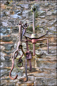
 Old machinery |
 Valley view |
 Old tractor |
|
After a short descent by a spring I came to a more substantial walled track which passed some surprisingly in-tact unoccupied buildings. The map calls one of them the ‘Loaning House’. Further down the lane was a pile of rubble on the left which had previously been two cottages. The only reason I know this is because a very informative information plaque had been fixed to the wall adjacent. I’m all in favour of this sort thing as it gives the casual walker a much better appreciation of what used to be in the countryside. I though it worth putting a full transcription here: |
 Lane Foot ruins |
|
These ruins were once two
cottages with sheds. A survey carried out in 2003 concluded that one
bilding was built in the late seventeenth century and another added at
the west end in the mid eighteenth century. They had mullioned windows
and probably a thatched roof. |
 |
|
|
The green lane soon met the B6270 in
Gunnerside and I returned to the car in fairly sunny and almost warm
conditions. |