|
Sedbergh, Hobdale Beck, Middle
Tongue, Calders, Arant Haw, Crosdale, Cumbria. |
|
|
I approached Sedbergh along Howgill Lane. It was nice to see the Wednesday market setting up out side the church gate. Wandering along Main Street many of the shops were open, even long before 9am. I turned left just before the Information Centre and headed up Joss Lane, through the gate and on to Hill Farm buildings. There was a nice view to the right of the ancient Saxon or Norman Motte & Bailey fortification. I followed the path by the buildings, into the field and down to Castlehaw Lane. Passing more buildings I came to the recently refurbished buildings that are now a bunk barn. |
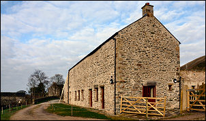 Bunk Barn |
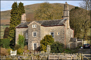 Stone Farm |
The continuing path through the fields is not well marked but eventually I emerged at Gill Farm and walked down the lane to Stone Farm. This is a fine old building and space for a datestone above the door was annoyingly blank. |
|
I crossed the fields to Hollin Hill where I was pleased to see a datestone showing EB 1712. Continuing through the fields I emerged on to Buckbank Lane at Ellerthwaite. After Thursgill I turned left to head straight up the fell side. After crossing a fence I headed for a gate in the wall high on the SE flank of Knott. |
 Hollin Hill |
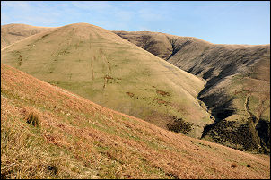 Middle Tongue |
|
|
The map shows a track starting here. It did and I followed it steadily up as it climbed above Hobdale Beck. It’s the first time I’ve visited this secluded valley and it must be one of the best hidden gems of the area. The track continued high in to Hobdale Gill until it reached the gill itself. This is where it stopped. I was heading for Middle Tongue so took a direct line straight up the steep fell-side. The climb was worth it and I emerged on to the ridge at a nice flat spot with a nearby spring of clear water. |
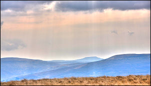
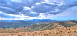
 The middle horizon is Great Dunn Fell |
|
|
A faint path follows the fence up on to Calders. It wasn’t particularly clear weather but the distant views were still there. I could see the radar station on Great Dunn Fell to the north and Ingleborough to the south. Over Calders I followed the main path south then took the indistinct Arant Haw branch. |
|
I came this way last week
when I took an early and steep descent into Crosdale. This time I
continued along the ridge to the west and took a much easier descent
down the SW ridge of Nab. As I descended I notice the outline of an
ancient settlement by Crosdale Beck above Craggstones. After my descent
I took a closer look then followed the easy path back to the gate,
walled track, Howgill Lane and my car. |
 South view from Calders. |