|
River Lune, Birkhaw, Bram Rigg
Top, Winder, Thwaite, Goodies, Cumbria. |
|
|
I left the car on a small patch of spare ground by the Crook of Lune Bridge, not to be confused with Crook of Lune near Lancaster. This one is near Lowgill, Tebay. It’s ideally suited to access the western side of the Howgill fells and that’s where I’m heading. I headed up the narrow lane towards Cookson’s Tenement and the Roman Road. There was still some snow about and the road surface was quite icy in places. The weather forecast was good but it was overcast when I set out and the fell tops were in cloud. At the Roman Road I turned right to head south towards the Church. I could have parked on the road there but I wasn’t sure if there would be enough room. After the church I turned left up Birkhaw Lane and noticed some wooden posts which were about to be used for some hedge laying that was underway, though nobody was about. After the farm building the track soon vanished under snow and passing Swarth Greaves I had to walk high above the track because of drifting behind the walls. Looking across Bram Rigg Beck the snow covered track up to Bram Rigg vanished into the mist and didn’t look very inviting. |
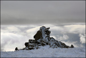
 Early sun on the fell. |
|
|
I took the diagonal route up to Seevy Rigg and managed to find a bit of shelter from the cold (-2degC) wind to eat an early lunch. As I continued up Bram Rigg the cloud began to clear a bit and fortunately the snow wasn’t too soft to make the going more difficult. Shortly before the summit I realised I’d got myself into a bit of a situation. An easy way continues directly, and safely, to the summit. Without thinking it through I’d followed the actual well defined path shown on the map. It runs along the very steep NW side of the hill and continues over towards Cautley Spout. The snow had drifted quite steeply and I realised that if it gave way or I slipped I’d have a one way and very fast descent to Calf Beck a long way below. I returned to the much safer ridge and continued to Bram Rigg Top and the main path which traverses the Howgills. I headed south and was soon on the summit of Calders. |
|
Even the simple descent to Rowantree Grains had to be taken with care due to patches of ice under the thin snow. I reached the trig point on the summit of Winder and stopped for a while to take in the views across Sedbergh and up to Garsdale. I descended back to Howgill Lane and headed north back to the Thwaite sign and turned left down New Road towards Thwaite farm. Approaching the farm the farmer was coming up the lane on his quad bike. He stopped to check if I’d seen any foxes which I told him I had. While eating my sandwiches I’d seen one across the valley on Brant Fell. |
|
|
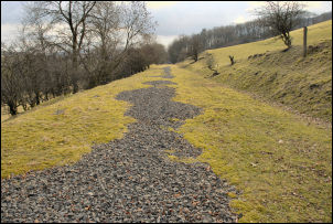
|
We chatted for a while and he recognised my Lancashire accent and I asked if he was local. His wife was but he came from Muker, Swaledale. Through his farm was a steep path down to the river Lune and a footbridge. I climbed up to the road at Goodies and crossed the line of the dismantled railway. The farmer told me that it was last used around 1961. I kept to the road as far as Davy Bank and took the path down to Pool House. The path wasn’t signposted and looking around I noticed that the sign was lying in the field behind the wall. Presumably to deter people legitimately accessing the public footpath. |