Return to
Whittle Wanderer
Return to
Whittle Wanderer|
Thirlmere, Armboth, High Tove,
Watendlath, Blea Tarn, Harrop Tarn, Cumbria. |
|
|
It was still dark when I reached the Thirlmere dam and the temperature was minus 7degC. I knew it would be cold so I’ve chosen one of the wettest areas of Cumbria which benefit from frozen ground. The main problem with the area now is that United Utilities have made all their parking areas ‘pay and display’. I drove south along the minor road along the west side of the reservoir as far as Dobgill car park. I decided not to leave my car there because of the charges. I drove back along the road to a lay bye near Launchy Gill and started my walk there. I walked north along the road passing several patches if ice and icicles hanging from the rocks. |
 Deer in Fisher Gill |
|
|
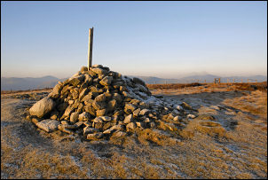
I reached the car park at Armboth and took the path left up Fisher Gill. It was still well below zero and the path was frozen solid with some stretches of sheet ice which I had to navigate round. As I left the wooded area I moved into more open ground and caught sight of a couple of Red Deer on the far side of the gill. I was now approaching the cairn on High Tove and remembered the last time I walked this way it was mostly horribly wet. There was no such problem today as the ground was still iron hard and tufts of grass surrounded by sheet ice meant I could hop from one tuft to the next. I had my ice studs with me but didn’t bother to use them. On the summit I had a nice view of most of the distant hills but the weather was a bit hazy. |
|
I carried straight on and started to descend to Watendlath. I’d hoped to walk round Watendlath Tarn and head up Bleatarn Gill but there was no footpath shown on the map and I couldn’t see any way round either. I reluctantly stayed high and didn’t descend to the farm but followed the way marked path towards Blea Tarn. I left the path in a few places to investigate the surroundings. All the way the views were very good. I headed up towards Shivery Knott to investigate an old collapsed sheepfold which wasn’t marked on the map. Because the hard ground was easy to cross I wandered about with impunity until I came to Blea Tarn. |
|
|
|
The outlet surface was partly choked with ice but the rest of the tarn was mostly clear. I kept near to the shore as I continued towards the pass that would take me back to the road at Dobgill Bridge. Once over the summit gate I descended to the forest and followed the path and then track down to Harrop Tarn. It was mostly frozen and some children were enjoying sliding overt he ice at the shallow end of the tarn. I followed the path by Dob Gill down to the tarmac road where I walked the mile and a half back to the car. Approaching Hause Point it was good to be able to see the stone structure on the straining well house. This was masked by trees the last time I was here. As I drove back I stopped briefly at the Thirlmere Dam to photograph the colourful plaque. |
|
|
|