|
Stonethwaite, Thornythwaite
Fell, Glaramara, High House Tarn, Langstrath, Cumbria. |
|
|
Drove to Stonethwaite in Borrowdale. It was just after 8am when I arrived and there were quite a few cars around considering how early it was. I set off along the lane towards the main B5289 road but before reaching it I turned left along the track to the Church and through the farm yard to follow the path through fields to Burthwaite Bridge. Here I joined the B5289 and followed it the short way to Strands Bridge where I turned left up the farm lane. At the next field boundary is a pedestrian gate on the left which I used to start my ascent up Thornythwaite Fell. Climbing Thornythwaite Fell was variable. The gradient changed quite a bit. It was easy to follow on the grass but some sections were scrambly rock. There wasn’t much to see up ahead but I occasionally stopped to look behind and see the increasing view down Borrowdale. |
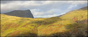 Across Seatoller Fell to Fleetwith Pike. |
|
|
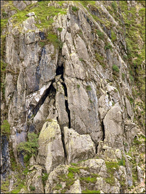
 Millican Dalton's sketch made in 1914 |
|
|
As I got higher I had a better view of Dovenest Crag where I walked last week. I took a photo of the rock face where Millican Dalton had made drawings of the various climbing routes. The path then flattens and gets wetter. Up ahead was the dome of Glaramara but the actual summit can’t be seen from this point. After the wet boggy stretch comes a short scramble up steep pitches of rock but the many hand and footholds make it easy and exhilarating. A flattish area follows then a couple of low hills which are the actual summit, though it’s difficult to tell which is the higher. |
|
The weather continued pretty good with high cloud and not much wind. I pressed on towards Allen Crags which I could see in the distance. The path heads steeply down to the top of Red Beck. I took a route to the right of the official path and was rewarded with magnificent views down into Grains Gill and Seathwaite. I came back to the path and headed for High House Tarn. I’d originally planned to walk over Allen Crags but decided to investigate a more direct route down into Langstrath instead. To the SE descent is gentle at first. I found a nice shelf with superb views. It would make a good camp sometime in the future. The next part of the descent was grassy and very slippery so extra care was needed. An area of large boulders followed then the horrible sight of a mix of loose rock and bracken below. Even more care was needed and it took ages to pick a way down to the river at Allencrags Gill. |
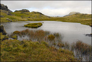 High House Tarn. |
|
|
The map shows a descent path here but I’ve never seen one. Over the river is Angletarn Gill and here was a path. I’ve used it before and I knew there was a fair way to go now down Langstrath The main path is on the right of Langstrath Beck and as far as I can see the only one. The map shows it on the other side of the river. I reached the footbridge at the foot of Stake Pass and saw the first walkers of the day, a couple of young men with backpacking sacks a short way in front. I followed them over the next bridge to start the main descent of Langstrath. I passed them and followed the stony and very wet path to Blackmoss Pot where the gate leads to a track. Substantial lengths had to be waded through, though it was quite shallow. I kept to the track on the left side of the river and followed it all the way to the campsite and on to Stonethwaite. A short way along the road I reached the car. |