|
Green Burn, Calf Crag, Greenup
Edge, Lining Crag, Stonethwaite, Cumbria. |
|
|
I drove through Borrowdale and left my car in the parking area along the Stonethwaite access road. I was early and spent a while reading before heading for the bus stop at the end of the road. I was waiting for the 79 bus to Keswick. I caught it on its way out to Seatoller and stayed on it for the return to Keswick. It was one of the open topped busses and I sat on the tope deck for the journey. The seats were wet from some recent rain and I still can’t understand the need for buses with no roof in this country. |
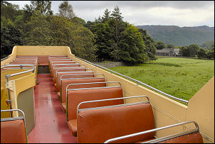 A wet bus to Keswick. |
|
|
I was in Keswick on time and then transferred to the 10:30am 555 bus to take me south to Town Head, at the base of Dunmail Raise and north of Grasmere. The bus stop is by a short lay-bye which used to be part of the old road. Just as I got off the heavens opened and I had to start walking in full waterproofs. I set off down the narrow lane to Helmside then right to the end of the lane at Turn House. Through a gate the path heads along a very wet and very muddy route between horrible ferns which make things even wetter. |
|
|
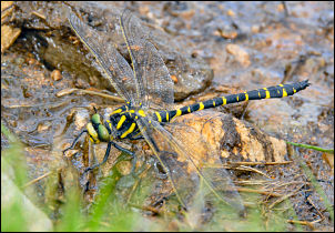 A dragonfly on the path. |
|
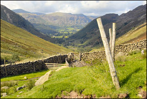
I was now heading up Green Burn, a valley I’ve never visited before. It’s very nice but would be much better in the winter when there are no ferns around. The rain eased and I was able get my sweaty waterproofs off and enjoy some comfort while walking. Higher up the path varies between very easy to see and very easy to miss. Wainwright recommends this as an ascent route but not descent, because it can be difficult to find in places. At the top of the climb I came to the more substantial path and a cairn on the ridge route between Moment Crag and Pike of Carrs. At Calf Crag I stopped for my lunch and found a very nice grassy flat spot with shelter from the slight wind and wonderful views down Far Easedale. At the top of Far Easedale Gill I saw other people about and now had to cross to Greenup Edge. A short descent leads to one of the wettest and horrible paths around. If ever a path needed stoning up this is it. I managed to keep my feet dry as I squelched across the bog to meet the slightly drier climb up the other side. |
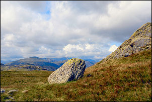 Greenup Edge summit. |
|
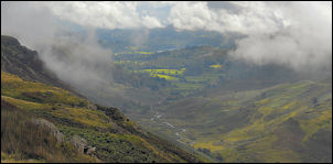
At Greenup Edge is the meeting of three paths, all indistinct. Fortunately I had good weather and good views to check my descent route towards Lining Crag. The first part of the path was indistinct and squelchy but improved as I got lower. I’d recently read Richard Hammond’s book ‘On the Edge’ and in it is a picture of him taken on a walk holiday across the Lake District. I recognised the picture as being taken on Lining Crag so took a picture at the same spot. |
|
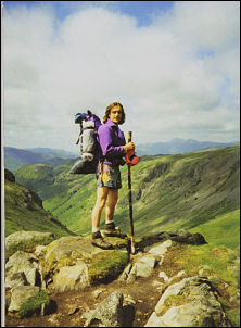 View from Lining Crag with Richard. |
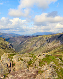 View from Lining Crag without Richard. |
|
|
I stopped a while to take
in the great scenery before negotiating the next part of the descent
which was quite steep. Down in the valley bottom the path was more
meandering and easy. As I approached Stonethwaite more people were
about. Across Stonethwaite Beck I could see the campsite which only had
a few tents on it, which is odd as its one of the nicest looking in the
area. A wet and stony path took me to Stonethwaite Bridge and the short
stretch of road back to my car. |