|
Barbondale, Gawthrop, Dent, Crag Hill, Bull Pot Farm, Cumbria. [18.5km] Tue 04th Dec 2007 |
|
|
I had a dark and wet drive to Barbondale, Cumbria. It was dark, wet and miserable when I arrived about 7:15am. The cloud was hanging just above the road level and it looked set for the day. The weather forecast hadn’t been too bad so that’s why I’m here. I parked at the south end the dale and set off north along the road. I was surprised by the amount of traffic in such a remote place but I suppose they are commuters coming from Dent and probably heading towards Lancaster. |
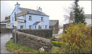
 Peas Gill House. |
|
|
I’d set off in full waterproofs as it was drizzling steadily but thankfully not too windy. I reached the high point then started on the steep descent into Gawthrop. The view along Dentdale was still misty and wet. In Dent village I turned right up the lane to the Green and sat on a bench to have a coffee before starting up the rough narrow lane to Flinter Gill. |
|
The river and small waterfalls were on the left and then a strange tree with exposed roots came in to view. The locals seemed to have names it the ‘Wishing Tree’ and fixed a sign on to say so. A bit further up was a restored limekiln and a good descriptive sign inside explaining what it was used for. As I climbed I came nearer to the cloud and the wind started to get up. I reached the top of the un-surfaced lane and reached a tee junction where I turned left. This track was fairly level and after a bridge crossing over Flinter Gill I followed a bend and then found some shelter behind the wall to eat my sandwiches. My next objective was Great Coum summit and I knew it was going to be an unpleasant experience as the way ahead was wet, windy and almost featureless. With compass handy I set off up the fell heading due south. |
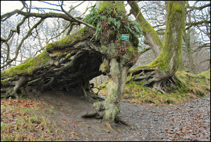 'Wishing Tree' Dent. |
|
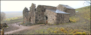
I was hoping to have a look at the Megger Stones but the visibility was so bad and it was too wet to get the camera out I just headed south to find the wall that would take me to the summit. I found the wall and followed it up to Holme Moss Pot area. Then another wall heads up left then another to the right until eventually the gradient eased and I was on the summit. This was familiar territory as I’d back-packed along here just a couple of weeks ago. I kept behind the wall to try and get some shelter from the screaming wind. I’d hoped to return via Gragarath but the weather was far too bad so I took the shorter route and headed west to Crag Hill. After a brief visit to the trig point I started the long wet descent to the SW towards Bull Pot Farm. It took a long time to get below the cloud and for the wind to ease but as I approached the Farm I could see what was in front of me. After the farm the route heads NW along a short track then descends along a wet path to Blindbeck Bridge and back to Barbondale. |
|