|
Great Asby Scar, Masongill, Holborn Hill settlement, Great Asby, Cumbria. Thu 09 Nov 2006 |
|
|
|
|
|
Left the car at a small parking area by the Orton – Appleby B6260 road. It was just after 7:30am when I arrived and no one was about. The weather was clear, cold and just coming light. I was heading for the Great Asby Scar area and set off along a track heading due east. Along it were a couple of gates which were locked. As there were no fences adjacent I didn’t see the point of the gates, you could either walk or drove round them. I came to a disused quarry on my right which looked like it hadn’t been abandoned that long, maybe 20years, but that’s just a wild guess. After a walled enclosure on my left I came to wall straight in front. To get to Great Asby Scar I’d need to climb over, which I don’t like doing with limestone because the walls can be crumbly. |
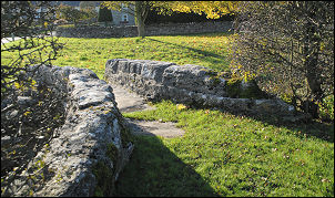
 Approaching Great Asby Scar. |
|
|
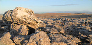
Fortunately this one was well made with bits sticking out, so I got over it without any damage. The other side was limestone pavement, which is nice to walk on in the dry, but very difficult in the wet. I headed off on a compass bearing to find the sunken green way that runs across the common. I soon arrived and found it a delight to walk on. Unfortunately I wasn’t on it long before I left it to strike across towards Masongill. More easy crossing of limestone pavement followed before descending to another high wall. Again I managed to find a bit with easy steps up and down so no damage was done. On the other side I followed a wire fence round to the line of an old track which is shown on the map. |
|
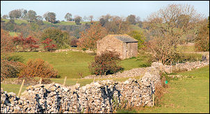
I arrived at the main Sunbiggin to Great Asby path but then confusion. The map shows the path on the east side of the wall and the sign shows it on the west. The map turned out to be wrong and this is just another of the many instances where the OS paths are wrong. How on earth could this happen? They produce the best topographical maps in the world and are still unable to put a path in the right place. Some more wall climbing was needed to get back on the right track but I soon found my objective, the settlement earthworks in a field to the west of Masongill. |
|
|
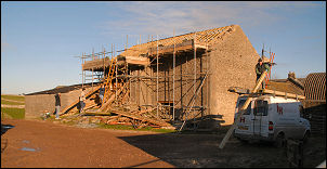
I followed the farm track till I reached the buildings. A van stood in the yard with a group of workmen sat in it. As I arrived they got out and started working on what looked like a re-roofing job. I carried on towards Asby Grange but turned left before getting there to descent to the valley bottom and pick up the official path again at Grange Hall. |
|
|
|
|
|
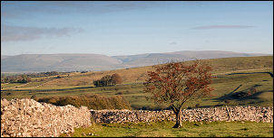
The map shows the position of an old settlement to the NW but I could find no trace of it. A bit further on I came to Holborn Hill and a very pronounced settlement. It was the perfect place to stop and have lunch. I sat there on a limestone outcrop wondering about the people who used to live there. |
|
|
|
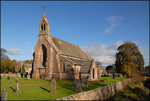
A path, muddy in places, took me to Great Asby. It was an interesting linear village with two parallel roads either side of a river. But the river was dry! A nice rebuilt stone bridge took me to St Peter’s Church. |
|
Over the road I walked SW to another bridge which had the wonderful original packhorse bridge next to it. I turned right here and up Dale Beck. The path up towards Halligill is not marked and not obvious. |
|
|
I ended up missing the turn and found myself wandering along the access track to Whitewall before realising my mistake. A car came along the farm track and the woman in it asked if I was lost. She was the farmer’s wife and I explained I’d realised my mistake and was about to return whence I came. We chatted a while and she pointed out a way across the field that would get me back to my correct route. I thanked her and took it. I followed the Halligill track then across fields to the road over Gaythorne Plane. I wasn’t on the road long before leaving it to cross the plane. A path is shown crossing it but for most of its route there is nothing to see on the ground. I was striding over humps and tussocks by the time I got back to my car. |
|