|
Threlkeld, Old Coach Road, Great Dodd, Calfhow Pike, Clough Head, Cumbria. Tue 26 Sep 2006 |
|
|
|
|
|
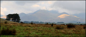
Because of a bad weather forecast for Wednesday I decided to go for my walk today, a day earlier than normal. It was a very misty drive up the M6 Motorway towards Penrith but the weather cleared a bit over Shap. I arrived in the Threlkeld area and drove down the cul-de-sac road towards Newsham and parked the car. The tops were still in cloud but the weather looked a bit brighter to the west. I set off south along the track, over the river Glenderamackin at Mill Bridge, then over the old railway bridge and up on to the fells. The path is good and easy to follow but is not shown at all on the map. |
|
|
|
Within half an hour I reached the Old Coach Road and turned left. I thought I’d try and find the Hause Well spring that is shown on the map and also illustrated in Wainwright’s ‘Eastern Fells’ book. I reached the exact spot but could find nothing more that a damp patch adjacent to the fence. There was certainly no running water. Perhaps it’s dried up? My plan was to reach the ford at Groove Beck and follow the Great Dodd path from there. I reached Mariel Bridge and looked at the fell adjacent to Wolf Crags and noticed a nice grassy ridge that looked a more picturesque alternative. I took it and wasn’t disappointed. |
|
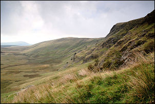
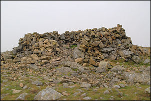
After a steep start the gradient eased as I crossed Matterdale Common to reach the main path. At Randerside a large cloud bank hovered over Great Dodd and I was soon in the mist and heading across featureless fell towards the summit. The summit wind shelter appeared out of the mist and with no views I didn’t stop but turned right and headed in the direction of the descent towards Calfhow Pike. |
|
|
|
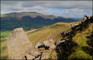
It was quite a while before I descended out of the cloud and was able to see the path descending below me. At the Pike the views had improved and the weather was clearing nicely. I walked across to Clough Head summit to take in the scenery. Blencathra was clear but Skiddaw summit was still in cloud. I then descended to Bennesty Knott and the top of Wanthwaite Crags where I stopped for lunch. The main path descending to Threlkeld Knotts starts on Bennesty Knott and is shown on the map. I’d seen another descent path a bit lower which is not shown on the map but is shown in Wainwright’s book. I decided to investigate it and found it to be another viable alternative, though there was no evidence of anyone having used it. I crossed Threlkeld Knotts and descended to the Old Coach Road before retracing my way along the path back to Mill Bridge and my car. |